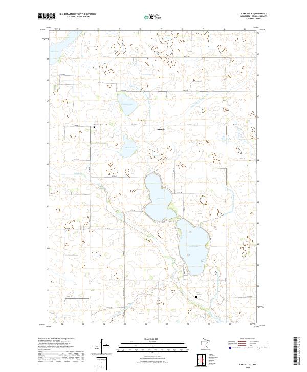
2022 Map of Lake Allie
USGS Topo · Published 2022About this map
Lake Allie and Preston Lake form the central hydrological focus of this Renville County landscape, where the prairie's natural drainage has been heavily modified for agriculture. The small settlement of Lakeside sits at the junction of Co Hwy 11 and Co Hwy 24, positioned between the larger lakes and the northern Hodgson Lake. This 2022 survey documents a complex system of water management, including Judicial Ditch Number One and County Ditch Number One Hundred Fourteen, which channel runoff through the section lines. For local historians and genealogists, the map identifies key burial sites such as Evergreen Cem and Preston Lake Cem. The terrain is characterized by these intermittent wetlands and named bodies like Boon Lake and Phare Lake, all set within the rigid township and range grid of T115N and T116N.
Find a feature on this map
50 named features on this map. Tap any name to fly to it.
Don’t see what you’re looking for? This feature index may not catch every label — zoom into the map to look around manually.
Map Details
Editions of this 2022 Lake Allie Map
This is the sole edition of this map. No revisions or reprints were ever made.
Other maps of this area

1953 · New Ulm
USGS Topo · 1:250,000

1957 · New Ulm
USGS Topo · 1:250,000

1958 · New Ulm
USGS Topo · 1:250,000

1958 · Winthrop
USGS Topo · 1:62,500

1958 · Hutchinson
USGS Topo · 1:62,500

1964 · Buffalo Lake
USGS Topo · 1:24,000

1964 · Hector
USGS Topo · 1:24,000

1967 · New Ulm
USGS Topo · 1:250,000

1967 · Churchill
USGS Topo · 1:24,000
1967 · Cedar Mills
USGS Topo · 1:24,000