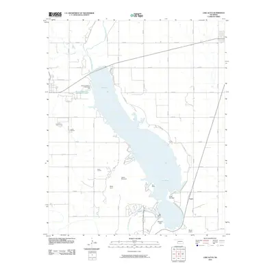
2010 Map of Lake Altus
USGS Topo · Published 2010About this map
Lake Altus dominates this Greer County landscape, formed by the Altus Dam where the North Fork Red River enters the Wichita Mountains region. The reservoir’s irregular shoreline is punctuated by prominent geological landmarks like Quartz Mountain, Baldy Point, and Twin Peaks, while the smaller State of Oklahoma Reformatory Lake and its associated State of Oklahoma Reformatory Dam sit to the northwest near the town of Granite. The settlement of Lugert is situated at the southern end of the lake, near the base of Mount Lugert and Williams Peak. For those researching local heritage, the map clearly identifies the Granite Cemetery and Quartz Cemetery, providing essential coordinates for family history. The transition from the flat agricultural plains of the north to the jagged peaks of the Quartz Mountains reflects a significant geological shift within this southwestern Oklahoma quadrangle.
Find a feature on this map
37 named features on this map. Tap any name to fly to it.
Don’t see what you’re looking for? This feature index may not catch every label — zoom into the map to look around manually.
Map Details
Editions of this 2010 Lake Altus Map
This is the sole edition of this map. No revisions or reprints were ever made.
Other maps of this area

1955 · Lawton
USGS Topo · 1:250,000

1955 · Clinton
USGS Topo · 1:250,000

1957 · Clinton
USGS Topo · 1:250,000

1961 · Hobart
USGS Topo · 1:62,500

1961 · Retrop
USGS Topo · 1:62,500

1964 · Lone Wolf
USGS Topo · 1:24,000

1964 · Warren
USGS Topo · 1:24,000

1971 · Blair
USGS Topo · 1:24,000

1971 · Granite
USGS Topo · 1:24,000

1971 · Hester
USGS Topo · 1:24,000