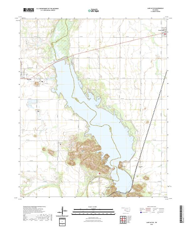
2022 Map of Lake Altus
USGS Topo · Published 2022About this map
Lake Altus dominates the central landscape of this western Oklahoma region, where the Greer and Kiowa county lines meet amidst a cluster of prominent granite peaks. The rugged topography is defined by elevations such as Quartz Mtn, Baldy Point, and Mt Lugert, which rise sharply above the surrounding plains. To the northwest, the town of Granite sits near the State of Oklahoma Reformatory Lake, while the settlement of Lone Wolf occupies the northeastern corner. The hydrologic network is anchored by the North Fork Red River and Elm Fork Red River, which feed into and drain from the primary reservoir. Local history is evidenced by the placement of the Granite Cem and Quartz Cem, along with the small community of Lugert situated near the southern base of Hicks Mtn.
Find a feature on this map
60 named features on this map. Tap any name to fly to it.
Don’t see what you’re looking for? This feature index may not catch every label — zoom into the map to look around manually.
Map Details
Editions of this 2022 Lake Altus Map
This is the sole edition of this map. No revisions or reprints were ever made.
Other maps of this area

1955 · Lawton
USGS Topo · 1:250,000

1955 · Clinton
USGS Topo · 1:250,000

1957 · Clinton
USGS Topo · 1:250,000

1961 · Hobart
USGS Topo · 1:62,500

1961 · Retrop
USGS Topo · 1:62,500

1964 · Lone Wolf
USGS Topo · 1:24,000

1964 · Warren
USGS Topo · 1:24,000

1971 · Blair
USGS Topo · 1:24,000

1971 · Granite
USGS Topo · 1:24,000

1971 · Hester
USGS Topo · 1:24,000