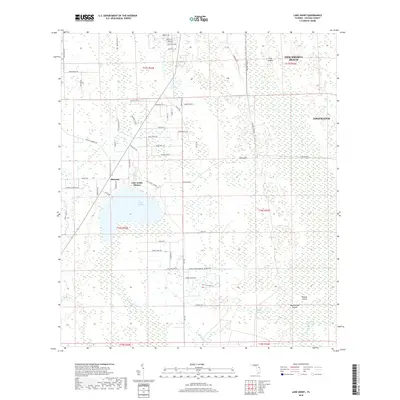
2018 Map of Lake Ashby
USGS Topo · Published 2018About this map
Lake Ashby dominates the central landscape of this Volusia County region, serving as a focal point for the small settlements of Alamana and Lake Ashby Shores. To the northeast, the outskirts of New Smyrna Beach and Edgewater reach into a network of low-lying wetlands and canals. The hydrologic patterns are clearly defined by the Samsula Canal and the Lake Ashby Canal, which manage the water flow across this flat coastal interior. To the southeast, the terrain transitions into the dense Spruce Creek Swamp, where isolated landforms like Watson Island and Rattlesnake Island emerge from the saturated environment. This survey captures a modern view of the area's rural residential development, where many roads like Alligator Ranch Rd and Dreamers Loop hint at the local character and land use of the late 2010s.
Find a feature on this map
73 named features on this map. Tap any name to fly to it.
Don’t see what you’re looking for? This feature index may not catch every label — zoom into the map to look around manually.
Map Details
Editions of this 2018 Lake Ashby Map
This is the sole edition of this map. No revisions or reprints were ever made.
Other maps of this area

1937 · Port Orange
USGS Topo · 1:48,000

1943 · Port Orange
USGS Topo · 1:62,500

1944 · Port Orange
USGS Topo · 1:62,500

1949 · Osceola
USGS Topo · 1:24,000

1950 · Maytown
USGS Topo · 1:24,000

1950 · Edgewater
USGS Topo · 1:24,000

1952 · Samsula
USGS Topo · 1:24,000

1954 · Daytona Beach
USGS Topo · 1:250,000

1955 · Orlando
USGS Topo · 1:250,000

1956 · New Smyrna Beach
USGS Topo · 1:24,000