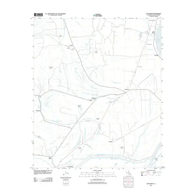
2012 Map of Lake Bruin
USGS Topo · Published 2012About this map
The complex hydrology of Tensas Parish is on display in this modern survey, defined by the winding paths of Big Choctaw Bayou, Routh Bayou, and Andrews Bayou. The landscape is a network of agricultural land and energy extraction, featuring numerous industrial sites such as the Crimea Gas Field, Buckhorn Oil Field, and the Aubrey Oil and Gas Field. Small communities and named locales like Crimea, Aubrey, and Denhart are scattered throughout the quadrangle, connected by a grid of parish roads including Old Stagg Rd. Local history is preserved in several rural burial grounds like Oneonta Cem, Gold Bell Cem, and Mound Cem. To the east, the shoreline of Lake Bruin and the Cottage Bend Revetment mark the transition toward the Mississippi River floodplain, while the Tensas Parish Airport serves as a regional transportation hub.
Find a feature on this map
48 named features on this map. Tap any name to fly to it.
Don’t see what you’re looking for? This feature index may not catch every label — zoom into the map to look around manually.
Map Details
Editions of this 2012 Lake Bruin Map
This is the sole edition of this map. No revisions or reprints were ever made.
Other maps of this area

1909 · Delta Bridge
USGS Topo · 1:24,000

1909 · Lake Bruen
USGS Topo · 1:24,000

1935 · Shackleford Lake
USGS Topo · 1:62,500

1939 · Lorman
USGS Topo · 1:62,500

1939 · Locust Ridge
USGS Topo · 1:62,500

1953 · Natchez
USGS Topo · 1:250,000

1955 · Jackson
USGS Topo · 1:250,000

1956 · Natchez
USGS Topo · 1:250,000

1958 · Shackleford Lake
USGS Topo · 1:62,500

1958 · St. Joseph
USGS Topo · 1:62,500