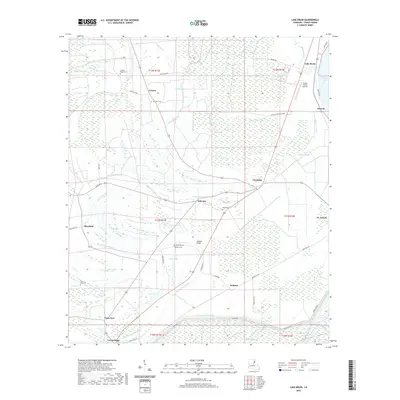
2020 Map of Lake Bruin
USGS Topo · Published 2020About this map
The alluvial plains of St. Joseph and the surrounding Tensas Parish lowlands are defined by an intricate network of waterways and drainage ditches. The landscape is dominated by the crescent of Lake Bruin and the winding course of Big Choctaw Bayou, which threads through agricultural lands marked by several plantation-era settlements. Local genealogy is well-represented through numerous burial grounds including Thistle Ridge Cem, Gold Bell Cem, and Cross Keys Cem, which are often located near small communities like Crimea and Maryland. The map reveals the infrastructure of this river-country environment, from the Hubbard Bridge spanning central bayous to the Tensas Flying Service airfield near the northern oxbow. Historically significant transport routes such as Osceola Plantation Dr and Old Stagg Rd trace the path of earlier development along the fertile ridges between the bayous.
Find a feature on this map
57 named features on this map. Tap any name to fly to it.
Don’t see what you’re looking for? This feature index may not catch every label — zoom into the map to look around manually.
Map Details
Editions of this 2020 Lake Bruin Map
This is the sole edition of this map. No revisions or reprints were ever made.
Other maps of this area

1909 · Delta Bridge
USGS Topo · 1:24,000

1909 · Lake Bruen
USGS Topo · 1:24,000

1935 · Shackleford Lake
USGS Topo · 1:62,500

1939 · Lorman
USGS Topo · 1:62,500

1939 · Locust Ridge
USGS Topo · 1:62,500

1953 · Natchez
USGS Topo · 1:250,000

1955 · Jackson
USGS Topo · 1:250,000

1956 · Natchez
USGS Topo · 1:250,000

1958 · Shackleford Lake
USGS Topo · 1:62,500

1958 · St. Joseph
USGS Topo · 1:62,500