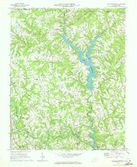
1969 Map of Lake Burlington
USGS Topo · Published 1972About this map
Stony Creek and its major impoundments dominate this late-1960s landscape, where the construction of Lake Burlington and the Stony Creek Reservoir reshaped the Piedmont topography. The area's industrial and textile heritage is evident at Glencoe and Altamahaw along the Haw River, where small mill settlements remained the focal points of local life. The map reveals a transition from traditional rural agriculture toward modern utility and recreation, marked by the presence of a Golf Course and a Pumping Sta supporting regional water needs.
Find a feature on this map
31 named features on this map. Tap any name to fly to it.
Don’t see what you’re looking for? This feature index may not catch every label — zoom into the map to look around manually.
Map Details
Editions of this 1969 Lake Burlington Map
2 editions found
Other maps of this area

1953 · Greensboro
USGS Topo · 1:250,000

1954 · Greensboro
USGS Topo · 1:250,000

1962 · Greensboro
USGS Topo · 1:250,000

1966 · Greensboro
USGS Topo · 1:250,000

1969 · Burlington
USGS Topo · 1:24,000

1969 · Mebane
USGS Topo · 1:24,000

1969 · Lake Burlington
USGS Topo · 1:24,000

1969 · Burlington NE
USGS Topo · 1:24,000

1970 · Gibsonville
USGS Topo · 1:24,000

1970 · Ossipee
USGS Topo · 1:24,000