
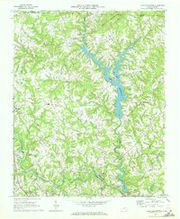
1969 Map of Lake Burlington
USGS Topo · Published 1972About this map
The Haw River carves through the southern landscape of this 1960s survey, anchoring a region of small rural settlements and evolving water resources. Mill villages like Glencoe and Carolina sit along the riverbanks, reflecting the industrial roots of the Piedmont, while the recently established Lake Burlington and Stony Creek Reservoir signal the growing municipal needs of the surrounding county. The terrain transitions from the heights of Stony Creek Mountain in the north down toward the rolling creek valleys that feed the larger reservoir system.
Find a feature on this map
29 named features on this map. Tap any name to fly to it.
Don’t see what you’re looking for? This feature index may not catch every label — zoom into the map to look around manually.
Map Details
Editions of this 1969 Lake Burlington Map
2 editions found
Other maps of this area

1953 · Greensboro
USGS Topo · 1:250,000

1954 · Greensboro
USGS Topo · 1:250,000

1962 · Greensboro
USGS Topo · 1:250,000

1966 · Greensboro
USGS Topo · 1:250,000

1969 · Burlington
USGS Topo · 1:24,000

1969 · Mebane
USGS Topo · 1:24,000

1969 · Burlington NE
USGS Topo · 1:24,000

1970 · Gibsonville
USGS Topo · 1:24,000

1970 · Ossipee
USGS Topo · 1:24,000
1972 · Anderson
USGS Topo · 1:24,000