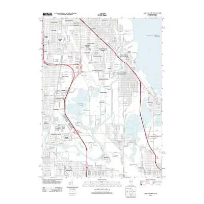
2012 Map of Lake Calumet
USGS Topo · Published 2012About this map
The heavy industrial and residential fabric of South Chicago is documented here along the Calumet River and the shores of Lake Michigan. The map highlights a dense network of neighborhoods including Chatham, Burnside, and the historic planned community of Pullman, where specific landmarks like Arcade Row are noted. The landscape is defined by its maritime and industrial heritage, visible in the numerous shipping slips such as the Semet Solvay Slip and Wisconsin Slip, alongside the critical Calumet Harbor Light. Educational institutions like Chicago State University and Olive-Harvey College are integrated into the urban grid, while recreational spaces like the Burnham Woods Golf Course and the waters of Wolf Lake provide a sharp contrast to the surrounding docks and rail corridors.
Find a feature on this map
73 named features on this map. Tap any name to fly to it.
Don’t see what you’re looking for? This feature index may not catch every label — zoom into the map to look around manually.
Map Details
Editions of this 2012 Lake Calumet Map
This is the sole edition of this map. No revisions or reprints were ever made.
Other maps of this area

1889 · Chicago
USGS Topo · 1:62,500

1891 · Chicago
USGS Topo · 1:62,500

1892 · Calumet
USGS Topo · 1:62,500

1893 · Calumet
USGS Topo · 1:62,500

1900 · Chicago
USGS Topo · 1:62,500

1900 · Toleston
USGS Topo · 1:62,500

1900 · Calumet
USGS Topo · 1:62,500

1901 · Calumet
USGS Topo · 1:62,500

1901 · Chicago
USGS Topo · 1:62,500

1929 · Calumet Lake
USGS Topo · 1:24,000