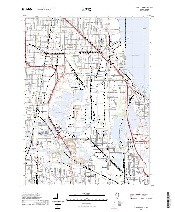
2024 Map of Lake Calumet
USGS Topo · Published 2024About this map
The industrial and residential corridors of south Chicago and northern Indiana meet in this recent survey, centered on the significant water bodies of Lake Calumet and Wolf Lake. The landscape is a complex patchwork of established neighborhoods and ecological restoration sites, including the Hyde Lake Wetlands, Indian Ridge Marsh, and the expansive Big Marsh. Historical industrial footprints are evident near the Calumet River, while the preservation of labor history is anchored by the Pullman National Monument.
Find a feature on this map
126 named features on this map. Tap any name to fly to it.
Don’t see what you’re looking for? This feature index may not catch every label — zoom into the map to look around manually.
Map Details
Editions of this 2024 Lake Calumet Map
This is the sole edition of this map. No revisions or reprints were ever made.
Other maps of this area

1889 · Chicago
USGS Topo · 1:62,500

1891 · Chicago
USGS Topo · 1:62,500

1892 · Calumet
USGS Topo · 1:62,500

1893 · Calumet
USGS Topo · 1:62,500

1900 · Chicago
USGS Topo · 1:62,500

1900 · Toleston
USGS Topo · 1:62,500

1900 · Calumet
USGS Topo · 1:62,500

1901 · Calumet
USGS Topo · 1:62,500

1901 · Chicago
USGS Topo · 1:62,500

1929 · Calumet Lake
USGS Topo · 1:24,000