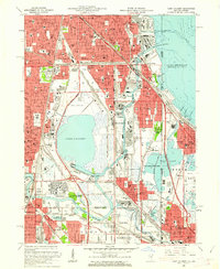
1960 Map of Lake Calumet
USGS Topo · Published 1962About this map
Lake Calumet dominates this industrial and residential landscape at the southern edge of Chicago, appearing as a focal point for massive mid-century infrastructure and heavy industry. This 1960 revision reveals the area during a period of significant transition, where the Skyway and Calumet Expressway cut through established neighborhoods like Pullman and Kensington. The map details a complex network of rail and water transport, featuring the Thomas J O'Brien Lock and Dam and multiple Calumet River turning basins that supported the region's manufacturing heart. Along the Illinois Indiana border, dense urban grids in South Chicago and East Side contrast with the wetland preserves of Eggers Woods Cook County Forest Preserve and Wolf Lake State Park. Cultural landmarks such as Mercy High Sch and St Casimir Sch serve as anchors for the local communities and immigrant parishes of the era.
Find a feature on this map
94 named features on this map. Tap any name to fly to it.
Don’t see what you’re looking for? This feature index may not catch every label — zoom into the map to look around manually.
Map Details
Editions of this 1960 Lake Calumet Map
This is the sole edition of this map. No revisions or reprints were ever made.
Other maps of this area

1889 · Chicago
USGS Topo · 1:62,500

1891 · Chicago
USGS Topo · 1:62,500

1892 · Calumet
USGS Topo · 1:62,500

1893 · Calumet
USGS Topo · 1:62,500

1900 · Chicago
USGS Topo · 1:62,500

1900 · Toleston
USGS Topo · 1:62,500

1900 · Calumet
USGS Topo · 1:62,500

1901 · Calumet
USGS Topo · 1:62,500

1901 · Chicago
USGS Topo · 1:62,500

1929 · Calumet Lake
USGS Topo · 1:24,000