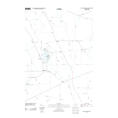
2013 Map of Lake Canadohta
USGS Topo · Published 2013About this map
Lake Canadohta serves as the focal point of this recreational and rural landscape, surrounded by small lakeside communities like Lakeville and Canadohta Lake. This region of Crawford County is characterized by a network of creeks and runs, including Oil Cr and Bloomfield Run, which weave through a terrain defined by features such as Dutch Hill and Shreve Ridge. The presence of the Canadohta Ski Slope and the Union City Golf Course suggests a transition toward leisure-based land use in a territory historically rooted in the crossroads hamlets of Lincolnville, Riceville, and Tillotson. Genealogists and local historians can trace the distribution of named corners, such as Pages Corners and Brimstone Corners, which illustrate the early settlement patterns of the township. The map provides a clear view of the secondary road network connecting these rural outposts, reflecting the enduring rural character of the Pennsylvania countryside.
Find a feature on this map
91 named features on this map. Tap any name to fly to it.
Don’t see what you’re looking for? This feature index may not catch every label — zoom into the map to look around manually.
Map Details
Editions of this 2013 Lake Canadohta Map
This is the sole edition of this map. No revisions or reprints were ever made.
Other maps of this area

1927 · Townville
USGS Topo · 1:48,000

1927 · Titusville
USGS Topo · 1:62,500

1929 · Corry
USGS Topo · 1:48,000

1929 · Union City
USGS Topo · 1:62,500

1932 · Corry
USGS Topo · 1:62,500

1932 · Townville
USGS Topo · 1:62,500

1932 · Union City
USGS Topo · 1:62,500

1933 · Titusville
USGS Topo · 1:62,500

1945 · Townville
USGS Topo · 1:62,500

1957 · Warren
USGS Topo · 1:250,000
Featured Places
- Clements Corners, PA
- Brimstone Corners, PA
- Athens Township, PA
- Bloomfield Township, PA
- Sparta Township, PA