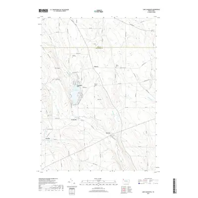
2019 Map of Lake Canadohta
USGS Topo · Published 2019About this map
Lake Canadohta and its surrounding resorts anchor this portion of Crawford County, where the transition from leisure lakeside living to traditional agricultural land is clearly mapped. The settlement of Canadohta Lake is detailed with a dense network of residential streets like Lakeview Dr and Elmwood Ave, contrasting with the more dispersed rural hamlets of Lincolnville, Riceville, and Tillotson. This landscape is heavily defined by the headwaters of Oil Creek, which winds southward through the valley floor past Dutch Hill.
Find a feature on this map
86 named features on this map. Tap any name to fly to it.
Don’t see what you’re looking for? This feature index may not catch every label — zoom into the map to look around manually.
Map Details
Editions of this 2019 Lake Canadohta Map
This is the sole edition of this map. No revisions or reprints were ever made.
Other maps of this area

1927 · Townville
USGS Topo · 1:48,000

1927 · Titusville
USGS Topo · 1:62,500

1929 · Corry
USGS Topo · 1:48,000

1929 · Union City
USGS Topo · 1:62,500

1932 · Corry
USGS Topo · 1:62,500

1932 · Townville
USGS Topo · 1:62,500

1932 · Union City
USGS Topo · 1:62,500

1933 · Titusville
USGS Topo · 1:62,500

1945 · Townville
USGS Topo · 1:62,500

1957 · Warren
USGS Topo · 1:250,000
Featured Places
- Clements Corners, PA
- Brimstone Corners, PA
- Athens Township, PA
- Bloomfield Township, PA
- Sparta Township, PA