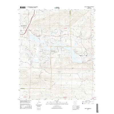
2017 Map of Lake Catherine
USGS Topo · Published 2017About this map
Lake Catherine and the Ouachita River dominate this modern topographical study of the border between Garland and Hot Spring counties. The landscape is defined by the heavy presence of recreational and residential development along the shoreline, featuring planned communities such as Diamondhead and Shorewood Hills. While the area is largely developed for leisure, industrial legacy remains visible in the Tailings Pond near Price and the namesake Jones Mills community. Local history and genealogy are anchored by the Irwin Cem and Price Cem, providing points of interest for those tracing family roots in the valley. The map also highlights established institutional sites like Camp Couchdale and Camp Tanako, tucked away near the many inlets of Spencer Bay and Slunger Bay. Rising above the water, prominent peaks such as Bald Mtn and Narrow Mtn provide the high-relief backdrop for this central Arkansas geography.
Find a feature on this map
111 named features on this map. Tap any name to fly to it.
Don’t see what you’re looking for? This feature index may not catch every label — zoom into the map to look around manually.
Map Details
Editions of this 2017 Lake Catherine Map
This is the sole edition of this map. No revisions or reprints were ever made.
Other maps of this area

1890 · Benton
USGS Topo · 1:125,000

1890 · Hot Springs
USGS Topo · 1:125,000

1894 · Hot Springs
USGS Topo · 1:125,000

1894 · Benton
USGS Topo · 1:125,000

1948 · Malvern
USGS Topo · 1:62,500

1949 · Malvern
USGS Topo · 1:62,500

1955 · Little Rock
USGS Topo · 1:250,000

1956 · Little Rock
USGS Topo · 1:250,000

1960 · Little Rock
USGS Topo · 1:250,000

1964 · Little Rock
USGS Topo · 1:250,000