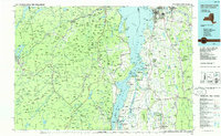
1986 Map of Lake Champlain South
USGS Topo · Published 1986About this map
Lake Champlain serves as the central spine of this 1986 planimetric study, dividing the high peaks of the eastern Adirondack Park in New York from the rolling valley floors of Vermont. The landscape is defined by its dramatic elevation changes, reaching from the shores of Shelburne Bay and Button Bay State Park to the summits of Mount Marcy and Whiteface Mountain. This era shows a well-established transportation network, where the Delaware & Hudson RR skirts the western lake margin and Interstate 89 connects the growing centers of Burlington and South Burlington. Inland, smaller hamlets like Mineville and Witherbee reflect the region's industrial heritage, while the presence of Middlebury College and the Crown Point State Historic Site highlights the area's long-standing role as a center for education and preserved history.
Find a feature on this map
79 named features on this map. Tap any name to fly to it.
Don’t see what you’re looking for? This feature index may not catch every label — zoom into the map to look around manually.
Map Details
Editions of this 1986 Lake Champlain South Map
2 editions found
Other maps of this area

1894 · Elizabethtown
USGS Topo · 1:62,500

1894 · Port Henry
USGS Topo · 1:62,500

1894 · Plattsburg
USGS Topo · 1:62,500

1894 · Ticonderoga
USGS Topo · 1:62,500

1895 · Willsboro
USGS Topo · 1:62,500

1895 · Elizabethtown
USGS Topo · 1:62,500

1895 · Mt. Marcy
USGS Topo · 1:62,500

1895 · Ausable
USGS Topo · 1:62,500

1895 · Paradox Lake
USGS Topo · 1:62,500

1896 · Lake Placid
USGS Topo · 1:62,500