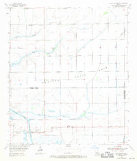
1955 Map of Lake Charles SW
USGS Topo · Published 1971About this map
South Lake Charles Gas Field and the Sweet Lake Oil Field define the mid-century industrial footprint south of the city, where extraction infrastructure sits amidst a complex network of coastal bayous and drainage channels. The landscape transitions from the higher Plateau Petit Bois down toward the marshy expanse of Big Lake at the southern edge. This 1950s survey captures a rural community organized around small landmarks like St Elizabeth Ch and Prairieland Sch, with the parish line between Calcasieu and Cameron cutting through the lower half of the quadrangle.
Find a feature on this map
17 named features on this map. Tap any name to fly to it.
Don’t see what you’re looking for? This feature index may not catch every label — zoom into the map to look around manually.
Map Details
Editions of this 1955 Lake Charles SW Map
3 editions found
Other maps of this area

1932 · Lake Charles NE
USGS Topo · 1:31,680

1932 · Moss Lake
USGS Topo · 1:31,680

1932 · Lake Charles NW
USGS Topo · 1:31,680

1932 · Lake Charles SW
USGS Topo · 1:31,680

1932 · Lake Charles SE
USGS Topo · 1:31,680

1934 · Sweet Lake
USGS Topo · 1:24,000

1934 · Boudreaux Lake
USGS Topo · 1:24,000

1935 · Sweet Lake
USGS Topo · 1:31,680

1935 · Hackberry
USGS Topo · 1:31,680

1935 · Boudreaux Lake
USGS Topo · 1:31,680