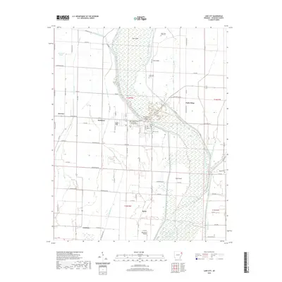
2020 Map of Lake City
USGS Topo · Published 2020About this map
Saint Francis River dominates the central landscape of this Eastern Arkansas territory, defining a complex network of wetlands and sloughs. The presence of the Craighead County Courthouse Eastern District in Lake City underscores the area's importance as a regional administrative hub. The terrain is characterized by slightly elevated "islands" and ridges, such as Gum Island, Cane Island, and Poplar Ridge, which historically provided stable ground for agriculture and settlement above the surrounding bottomlands. To the south, the flat expanse of Maumelle Prairie transitions into the drainage areas of Purcell Slough and Ditch Number 1. This document preserves the locations of several community burial grounds, including the Upper Cane Island Cem and Lower Cane Island Cem, alongside established rural settlements like Bowman and Southland.
Find a feature on this map
87 named features on this map. Tap any name to fly to it.
Don’t see what you’re looking for? This feature index may not catch every label — zoom into the map to look around manually.
Map Details
Editions of this 2020 Lake City Map
This is the sole edition of this map. No revisions or reprints were ever made.
Other maps of this area

1939 · Jonesboro
USGS Topo · 1:62,500

1940 · Dee
USGS Topo · 1:62,500

1941 · Leachville
USGS Topo · 1:62,500

1941 · Marked Tree
USGS Topo · 1:62,500

1953 · Memphis
USGS Topo · 1:250,000

1956 · Leachville
USGS Topo · 1:62,500

1956 · Marked Tree
USGS Topo · 1:62,500

1956 · Memphis
USGS Topo · 1:250,000

1958 · Dee
USGS Topo · 1:62,500

1958 · Jonesboro
USGS Topo · 1:62,500