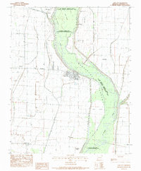
1983 Map of Lake City
USGS Topo · Published 1984About this map
Lake City serves as the focal point of this Craighead County landscape, situated where the St Francis River and its accompanying St Francis Sunken Lands State Wildlife Management Area dominate the eastern topography. The map reveals an intricate network of drainage systems essential to the region's agricultural character, including Big Bay Ditch and Purcell Slough. These man-made and natural waterways define the boundaries of local life, bordering small communities like Southland, Lunsford, and Claunch.
Find a feature on this map
37 named features on this map. Tap any name to fly to it.
Don’t see what you’re looking for? This feature index may not catch every label — zoom into the map to look around manually.
Map Details
Editions of this 1983 Lake City Map
This is the sole edition of this map. No revisions or reprints were ever made.
Other maps of this area

1939 · Jonesboro
USGS Topo · 1:62,500

1940 · Dee
USGS Topo · 1:62,500

1941 · Leachville
USGS Topo · 1:62,500

1941 · Marked Tree
USGS Topo · 1:62,500

1953 · Memphis
USGS Topo · 1:250,000

1956 · Leachville
USGS Topo · 1:62,500

1956 · Marked Tree
USGS Topo · 1:62,500

1956 · Memphis
USGS Topo · 1:250,000

1958 · Dee
USGS Topo · 1:62,500

1958 · Jonesboro
USGS Topo · 1:62,500