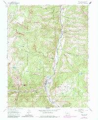
1963 Map of Lake City
USGS Topo · Published 1984About this map
Lake City serves as the focal point of this high-country survey, situated at the confluence of Henson Creek and the Lake Fork Gunnison River. The settlement is flanked by the New Cem and Old Cem, reflecting the early community's established presence. Mining activity defines the southern and western periphery, with numerous named operations like the Hidden Treasure Mine, California Mine, and Golden Wonder Mine dotting the steep terrain of Neoga Mountain and Crystal Peak.
Find a feature on this map
48 named features on this map. Tap any name to fly to it.
Don’t see what you’re looking for? This feature index may not catch every label — zoom into the map to look around manually.
Map Details
Editions of this 1963 Lake City Map
3 editions found
Other maps of this area

1903 · Lake City
USGS Topo · 1:62,500

1905 · Lake City
USGS Topo · 1:62,500

1905 · San Cristobal
USGS Topo · 1:125,000

1907 · San Cristobal
USGS Topo · 1:125,000

1908 · Uncompahgre
USGS Topo · 1:125,000

1911 · Uncompahgre
USGS Topo · 1:125,000

1945 · Durango
USGS Topo · 1:250,000

1953 · Durango
USGS Topo · 1:250,000

1954 · Durango
USGS Topo · 1:250,000

1956 · Montrose
USGS Topo · 1:250,000