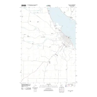
2010 Map of Lake City
USGS Topo · Published 2010About this map
Lake City occupies a prominent position on the western shore of the Mississippi River, where its urban grid meets the mouth of Miller Creek. This early 21st-century documentation illustrates the dense concentration of civic and spiritual sites within the town, including Saint Marys Academy and the Lake City Post Office. The landscape is notably dense with burial grounds, clustering several like Bethany Cemetery, Oakwood Cemetery, and Saint Johns Cemetery along the town's southern edge. Across the river in Wisconsin, the settlement of Stockholm sits below the bluffs, near the Old Stockholm Cemetery. The surrounding Minnesota uplands are defined by a series of deep ravines such as Boston Coulee and Moran Coulee, while infrastructure like the Ralph Lenz Detention Structure Dam and William Dankwart Dam indicates local water management on the creeks feeding the river valley.
Find a feature on this map
65 named features on this map. Tap any name to fly to it.
Don’t see what you’re looking for? This feature index may not catch every label — zoom into the map to look around manually.
Map Details
Editions of this 2010 Lake City Map
This is the sole edition of this map. No revisions or reprints were ever made.
Other maps of this area

1932 · Wabasha
USGS Topo · 1:62,500

1935 · Arkansaw
USGS Topo · 1:48,000

1940 · Maiden Rock
USGS Topo · 1:62,500

1941 · Arkansaw
USGS Topo · 1:62,500

1942 · Arkansaw
USGS Topo · 1:62,500

1950 · Maiden Rock
USGS Topo · 1:62,500

1951 · Wabasha
USGS Topo · 1:62,500

1951 · Lake City
USGS Topo · 1:62,500

1953 · Saint Paul
USGS Topo · 1:250,000

1959 · Saint Paul
USGS Topo · 1:250,000