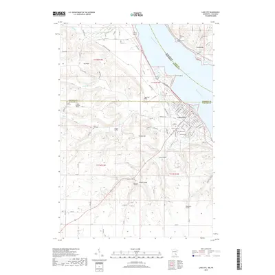
2019 Map of Lake City
USGS Topo · Published 2019About this map
Lake City and its riverfront setting along the widening of the Mississippi River known as Lake Pepin define this river valley landscape. The terrain shifts from the prominent Sugarloaf Bluff and Oak Ridge down to the established grid of the city, which serves as a hub for local history. For genealogists, the map is remarkably dense with burial grounds, including Oakwood Cem, Saint Marys Cem, and Lakewood Cem on the Minnesota side, while across the water in Wisconsin lie the Old Stockholm Cem and Oakland Cem.
Find a feature on this map
120 named features on this map. Tap any name to fly to it.
Don’t see what you’re looking for? This feature index may not catch every label — zoom into the map to look around manually.
Map Details
Editions of this 2019 Lake City Map
This is the sole edition of this map. No revisions or reprints were ever made.
Other maps of this area

1932 · Wabasha
USGS Topo · 1:62,500

1935 · Arkansaw
USGS Topo · 1:48,000

1940 · Maiden Rock
USGS Topo · 1:62,500

1941 · Arkansaw
USGS Topo · 1:62,500

1942 · Arkansaw
USGS Topo · 1:62,500

1950 · Maiden Rock
USGS Topo · 1:62,500

1951 · Wabasha
USGS Topo · 1:62,500

1951 · Lake City
USGS Topo · 1:62,500

1953 · Saint Paul
USGS Topo · 1:250,000

1959 · Saint Paul
USGS Topo · 1:250,000