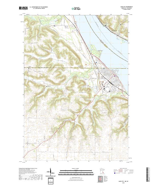
2022 Map of Lake City
USGS Topo · Published 2022About this map
Lake City occupies a prominent position on the western shore of the Mississippi River and Lake Pepin, where the local landscape transitions from the riverfront into the steep bluffs of Sugarloaf Bluff and West Florence Ridge. The map reveals a dense concentration of civic and genealogical sites within the town, including Oakwood Cem, Saint Johns Cem, and Lakewood Cem. Across the water in Wisconsin, the settlement of Stockholm is visible, along with the Old Stockholm Cem. The surrounding uplands are defined by a series of deep coulees, such as Boston Coulee and Moran Coulee, which channel drainage from Gilbert Valley toward the river valley. This network of ridges and ravines dictated the historical placement of upland settlements like Oak Ridge and the winding path of the Territorial Road Trl.
Find a feature on this map
125 named features on this map. Tap any name to fly to it.
Don’t see what you’re looking for? This feature index may not catch every label — zoom into the map to look around manually.
Map Details
Editions of this 2022 Lake City Map
This is the sole edition of this map. No revisions or reprints were ever made.
Other maps of this area

1932 · Wabasha
USGS Topo · 1:62,500

1935 · Arkansaw
USGS Topo · 1:48,000

1940 · Maiden Rock
USGS Topo · 1:62,500

1941 · Arkansaw
USGS Topo · 1:62,500

1942 · Arkansaw
USGS Topo · 1:62,500

1950 · Maiden Rock
USGS Topo · 1:62,500

1951 · Wabasha
USGS Topo · 1:62,500

1951 · Lake City
USGS Topo · 1:62,500

1953 · Saint Paul
USGS Topo · 1:250,000

1959 · Saint Paul
USGS Topo · 1:250,000