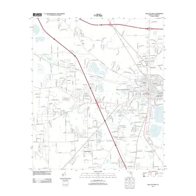
2012 Map of Lake City West
USGS Topo · Published 2012About this map
Lake City is anchored in the east by a cluster of civic and water features, including Lake Isabella, Lake Soto, and the Lake City Water Tower. This 2012 survey illustrates the suburban expansion westward from the city center, characterized by residential developments like Rolling Meadows and the intersection of major transit corridors. The landscape is dotted with small lakes and ponds, from the northern Lake Jeffery and Lake Harris to the larger Alligator Lake along the southeastern boundary.
Find a feature on this map
261 named features on this map. Tap any name to fly to it.
Don’t see what you’re looking for? This feature index may not catch every label — zoom into the map to look around manually.
Map Details
Editions of this 2012 Lake City West Map
This is the sole edition of this map. No revisions or reprints were ever made.
Other maps of this area

1954 · Valdosta
USGS Topo · 1:250,000

1958 · Valdosta
USGS Topo · 1:250,000

1959 · Valdosta
USGS Topo · 1:250,000

1961 · Deep Creek
USGS Topo · 1:24,000

1961 · White Springs East
USGS Topo · 1:24,000

1961 · White Springs West
USGS Topo · 1:24,000

1962 · Lake City East
USGS Topo · 1:24,000

1963 · Ellisville
USGS Topo · 1:24,000

1963 · Columbia
USGS Topo · 1:24,000

1963 · Lake City West
USGS Topo · 1:24,000