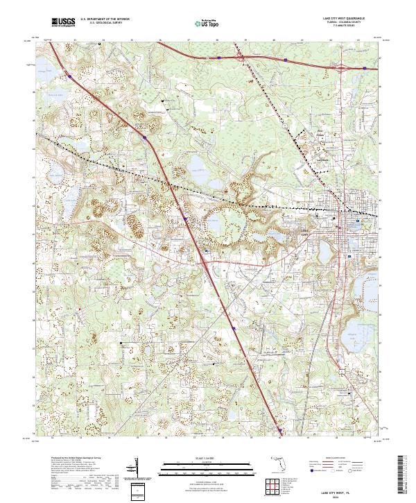
2024 Map of Lake City West
USGS Topo · Published 2024About this map
Lake City serves as the focal point of this North Florida survey, revealing the dense grid of the city's western half and its transition into the lake-strewn landscape of Columbia County. The downtown area is anchored by the Columbia County Courthouse, while residential growth extends toward the unincorporated communities of Five Points and Lacymark. The map is particularly valuable for genealogical research, documenting numerous burial grounds such as Oak Lawn Cem, Jerusalem Cem, and the Forest Lawn Memorial Gardens Cem.
Find a feature on this map
263 named features on this map. Tap any name to fly to it.
Don’t see what you’re looking for? This feature index may not catch every label — zoom into the map to look around manually.
Map Details
Editions of this 2024 Lake City West Map
This is the sole edition of this map. No revisions or reprints were ever made.
Other maps of this area

1954 · Valdosta
USGS Topo · 1:250,000

1958 · Valdosta
USGS Topo · 1:250,000

1959 · Valdosta
USGS Topo · 1:250,000

1961 · Deep Creek
USGS Topo · 1:24,000

1961 · White Springs East
USGS Topo · 1:24,000

1961 · White Springs West
USGS Topo · 1:24,000

1962 · Lake City East
USGS Topo · 1:24,000

1963 · Ellisville
USGS Topo · 1:24,000

1963 · Columbia
USGS Topo · 1:24,000

1963 · Lake City West
USGS Topo · 1:24,000