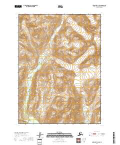
2018 Map of Lake Clark A-1 SW
USGS Topo · Published 2018About this map
Lake Clark National Park encompasses this high-altitude landscape within the Kenai Peninsula, where active glaciation continues to carve the terrain. The hydrological network is dominated by glacial runoff, most notably from the massive Tuxedni Glacier in the northeast and Umbrella Glacier along the southern boundary. These ice masses feed complex drainage systems, including the Left Fork West Glacier Creek and Right Fork W Glacier Cr, which navigate steep elevation changes indicated by dense contour intervals. The map reveals a wilderness largely devoid of human infrastructure, preserving a primitive environment where geological and hydrological processes are the primary architects of the land. This survey provides a precise record of glacial margins and stream courses at the start of the 21st century, offering essential data for researchers monitoring changes in Alaska's ice-dominated ecosystems.
Find a feature on this map
10 named features on this map. Tap any name to fly to it.
Don’t see what you’re looking for? This feature index may not catch every label — zoom into the map to look around manually.
Map Details
Editions of this 2018 Lake Clark A-1 SW Map
This is the sole edition of this map. No revisions or reprints were ever made.
Other maps of this area

1946 · Lake Clark
USGS Topo · 1:250,000

1951 · Lake Clark
USGS Topo · 1:250,000

1952 · Iliamna
USGS Topo · 1:250,000

1957 · Iliamna
USGS Topo · 1:250,000

1958 · Iliamna D-2
USGS Topo · 1:63,360

1958 · Iliamna D-1
USGS Topo · 1:63,360

1958 · Lake Clark A-1
USGS Topo · 1:63,360
1958 · Lake Clark A-2
USGS Topo · 1:63,360

1958 · Lake Clark
USGS Topo · 1:250,000
2018 · Lake Clark A-1 NE
USGS Topo · 1:25,000