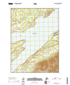
2018 Map of Lake Clark A-4 NW
USGS Topo · Published 2018About this map
Port Alsworth serves as a central hub on this 2018 survey, situated on the eastern shores of Lake Clark. The landscape is defined by the boundary between the Lake Clark National Preserve and Lake Clark National Park, showing the protected status of these remote Alaskan reaches. Transportation into this isolated settlement is anchored by two landing strips: Port Alsworth Airport and the Wilder/Natwick LLC Airport, highlighting the region's reliance on aviation for connectivity. Notable shoreline features include Tanalian Point and Cape Shishkin, while the Tanalian River flows into the lake near the townsite. The presence of local routes like Ridge Road and Alder Road around the settlement provides a granular look at the small-scale development within the broader wilderness of the Lake and Peninsula Borough.
Find a feature on this map
17 named features on this map. Tap any name to fly to it.
Don’t see what you’re looking for? This feature index may not catch every label — zoom into the map to look around manually.
Map Details
Editions of this 2018 Lake Clark A-4 NW Map
This is the sole edition of this map. No revisions or reprints were ever made.
Other maps of this area

1946 · Lake Clark
USGS Topo · 1:250,000

1951 · Lake Clark
USGS Topo · 1:250,000

1954 · Lake Clark B-5
USGS Topo · 1:63,360

1954 · Lake Clark A-4
USGS Topo · 1:63,360

1954 · Lake Clark A-5
USGS Topo · 1:63,360

1954 · Lake Clark B-4
USGS Topo · 1:63,360

1958 · Lake Clark
USGS Topo · 1:250,000
2018 · Lake Clark A-4 SW
USGS Topo · 1:25,000
2018 · Lake Clark A-5 NE
USGS Topo · 1:25,000
2018 · Lake Clark A-4 NE
USGS Topo · 1:25,000