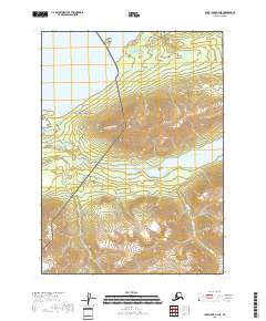
2018 Map of Lake Clark A-4 NE
USGS Topo · Published 2018About this map
Tanalian Mtn dominates the central landscape of this 2018 survey, rising above the transition between Lake Clark National Preserve and Lake Clark National Park. The map documents a specialized network of foot travel, including the Tanalian Falls Trail, Beaver Pond Trail, and the long Tanalian Mountain Trail, which climbs the slopes overlooking Hardenburg Bay.
Find a feature on this map
20 named features on this map. Tap any name to fly to it.
Don’t see what you’re looking for? This feature index may not catch every label — zoom into the map to look around manually.
Map Details
Editions of this 2018 Lake Clark A-4 NE Map
This is the sole edition of this map. No revisions or reprints were ever made.
Other maps of this area

1946 · Lake Clark
USGS Topo · 1:250,000

1951 · Lake Clark
USGS Topo · 1:250,000

1954 · Lake Clark A-3
USGS Topo · 1:63,360

1954 · Lake Clark B-3
USGS Topo · 1:63,360

1954 · Lake Clark A-4
USGS Topo · 1:63,360

1954 · Lake Clark B-4
USGS Topo · 1:63,360

1958 · Lake Clark
USGS Topo · 1:250,000
2018 · Lake Clark A-4 SW
USGS Topo · 1:25,000
2018 · Lake Clark A-4 NW
USGS Topo · 1:25,000
2018 · Lake Clark B-4 SW
USGS Topo · 1:25,000