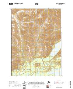
2018 Map of Lake Clark B-4 SW
USGS Topo · Published 2018About this map
Lake Clark National Preserve dominates this terrain, protecting a landscape where high mountain ridges descend into a vast network of glacial waters. The transition from the steep, closely contoured peaks of the northern townships into the low-lying wetlands and alluvial plains of the south illustrates the dynamic geography of the Lake and Peninsula Borough. In the southeast, the waters of Kijik Lake sit at the foot of these slopes, while the northern tip of Lake Clark itself enters the frame, marking a critical water corridor in this part of Alaska. The absence of roads or permanent structures reflects the protected and primitive state of the land as documented by the U.S. Geological Survey in 2018.
Find a feature on this map
7 named features on this map. Tap any name to fly to it.
Don’t see what you’re looking for? This feature index may not catch every label — zoom into the map to look around manually.
Map Details
Editions of this 2018 Lake Clark B-4 SW Map
This is the sole edition of this map. No revisions or reprints were ever made.
Other maps of this area

1946 · Lake Clark
USGS Topo · 1:250,000

1951 · Lake Clark
USGS Topo · 1:250,000

1954 · Lake Clark B-5
USGS Topo · 1:63,360

1954 · Lake Clark A-4
USGS Topo · 1:63,360

1954 · Lake Clark A-5
USGS Topo · 1:63,360

1954 · Lake Clark B-4
USGS Topo · 1:63,360

1958 · Lake Clark
USGS Topo · 1:250,000
2018 · Lake Clark A-4 NW
USGS Topo · 1:25,000
2018 · Lake Clark B-4 NW
USGS Topo · 1:25,000
2018 · Lake Clark B-4 NE
USGS Topo · 1:25,000