
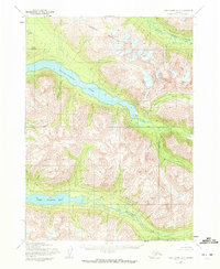
1954 Map of Lake Clark A-3
USGS Topo · Published 1965About this map
Kontrashibuna Lake dominates this mid-century topographic study, cutting through the high elevations of the Alaska interior. The landscape is defined by its dramatic relief, where Copper Mountain and Tanalian Mountain tower over glacial valleys and alpine basins. Mapping efforts by the Army Map Service and the Geological Survey emphasize the hydrologic network that feeds into these large water bodies, including Kazan Creek and the intricate Gladiator Basin. To the south, Upper Tazimina Lake sits framed by steep contours, reflecting a wilderness state where land lines were predetermined by the Bureau of Land Management but remained largely unsurveyed on the ground. The presence of the Base Line crossing through the central valley indicates the foundational work required to organize this territory during the 1950s territorial era.
Find a feature on this map
11 named features on this map. Tap any name to fly to it.
Don’t see what you’re looking for? This feature index may not catch every label — zoom into the map to look around manually.
Map Details
Editions of this 1954 Lake Clark A-3 Map
2 editions found
Other maps of this area

1946 · Lake Clark
USGS Topo · 1:250,000

1951 · Lake Clark
USGS Topo · 1:250,000

1952 · Iliamna
USGS Topo · 1:250,000

1954 · Iliamna D-3
USGS Topo · 1:63,360

1954 · Lake Clark B-3
USGS Topo · 1:63,360

1954 · Iliamna D-4
USGS Topo · 1:63,360

1954 · Lake Clark A-4
USGS Topo · 1:63,360

1954 · Lake Clark B-4
USGS Topo · 1:63,360

1957 · Iliamna
USGS Topo · 1:250,000

1958 · Iliamna D-2
USGS Topo · 1:63,360