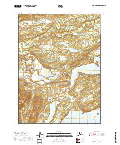
2018 Map of Lake Clark A-5 NE
USGS Topo · Published 2018About this map
Lake Clark National Preserve dominates this 2018 survey, which documents the intricate aquatic landscape where the Chulitna River meets the expansive waters of Lake Clark. This transition between riverine and lacustrine environments is marked by deep indentations along the shoreline, including Turner Bay, Chulitna Bay, and Portage Bay. The map provides a high-resolution view of the hydrology of the Lake and Peninsula Borough, illustrating how the meandering river system feeds into the larger lake. This protected wilderness area is characterized by its absence of modern infrastructure, preserving a primary corridor for the region's natural hydrography and traditional movement through the interior of Alaska.
Find a feature on this map
11 named features on this map. Tap any name to fly to it.
Don’t see what you’re looking for? This feature index may not catch every label — zoom into the map to look around manually.
Map Details
Editions of this 2018 Lake Clark A-5 NE Map
This is the sole edition of this map. No revisions or reprints were ever made.
Other maps of this area

1946 · Lake Clark
USGS Topo · 1:250,000

1951 · Lake Clark
USGS Topo · 1:250,000

1954 · Lake Clark B-5
USGS Topo · 1:63,360

1954 · Lake Clark A-4
USGS Topo · 1:63,360

1954 · Lake Clark A-5
USGS Topo · 1:63,360

1954 · Lake Clark B-4
USGS Topo · 1:63,360

1958 · Lake Clark
USGS Topo · 1:250,000
2018 · Lake Clark A-5 SW
USGS Topo · 1:25,000
2018 · Lake Clark A-4 SW
USGS Topo · 1:25,000
2018 · Lake Clark A-4 NW
USGS Topo · 1:25,000