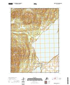
2018 Map of Lake Clark A-5 SW
USGS Topo · Published 2018About this map
Nondalton sits near the southwestern reaches of this survey, serving as a primary settlement point at the head of Sixmile Lake. The landscape is dominated by the transition from the aquatic depths of Lake Clark to the high elevations of Hoknede Mtn in the southwest corner. Large portions of the eastern and northern terrain are managed as part of the Lake Clark National Preserve, protecting a wilderness area where internal lakes like the Pickerel Lakes dot the low-lying wetlands. The cartography reveals a complex hydrography where the massive lake system funnels into narrower channels, influencing the location of local infrastructure and the historical development of the village site. This modern topographic record captures the area's essential geographic character, from its sharp mountain peaks to the vast interior waters that define life in the Lake and Peninsula Borough.
Find a feature on this map
10 named features on this map. Tap any name to fly to it.
Don’t see what you’re looking for? This feature index may not catch every label — zoom into the map to look around manually.
Map Details
Editions of this 2018 Lake Clark A-5 SW Map
This is the sole edition of this map. No revisions or reprints were ever made.
Other maps of this area

1946 · Lake Clark
USGS Topo · 1:250,000

1951 · Lake Clark
USGS Topo · 1:250,000

1952 · Iliamna
USGS Topo · 1:250,000

1954 · Lake Clark A-6
USGS Topo · 1:63,360

1954 · Lake Clark A-5
USGS Topo · 1:63,360

1954 · Iliamna D-5
USGS Topo · 1:63,360
1954 · Iliamna D-6
USGS Topo · 1:63,360

1957 · Iliamna
USGS Topo · 1:250,000

1958 · Lake Clark
USGS Topo · 1:250,000
2018 · Iliamna D-5 NW
USGS Topo · 1:25,000