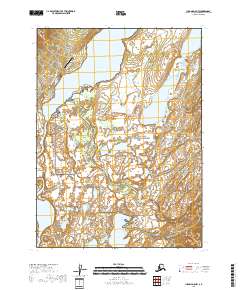
2018 Map of Iliamna D-5 NW
USGS Topo · Published 2018About this map
Nondalton occupies a strategic position on the western shore of Sixmile Lake, serving as a vital interior settlement where the Newhalen River system connects deep into the Alaska wilderness. The town's infrastructure, including the Nondalton Airport and a small network of streets like Main Street and Boundary Street, reflects a community organized around river access and aviation. To the east, the landscape transitions into the protected wilderness of the Lake Clark National Preserve, a vast expanse defined by the meandering course of the Tazimina River and numerous water bodies such as Pickerel Lakes and Alexey Lake. The presence of the Iliamna-Nondalton-Newhalen River Road underscores the importance of this corridor for regional travel between remote drainage systems.
Find a feature on this map
20 named features on this map. Tap any name to fly to it.
Don’t see what you’re looking for? This feature index may not catch every label — zoom into the map to look around manually.
Map Details
Editions of this 2018 Iliamna D-5 NW Map
This is the sole edition of this map. No revisions or reprints were ever made.
Other maps of this area

1946 · Lake Clark
USGS Topo · 1:250,000

1951 · Lake Clark
USGS Topo · 1:250,000

1952 · Iliamna
USGS Topo · 1:250,000

1954 · Lake Clark A-6
USGS Topo · 1:63,360

1954 · Lake Clark A-5
USGS Topo · 1:63,360

1954 · Iliamna D-5
USGS Topo · 1:63,360
1954 · Iliamna D-6
USGS Topo · 1:63,360

1957 · Iliamna
USGS Topo · 1:250,000

1958 · Lake Clark
USGS Topo · 1:250,000
2018 · Iliamna D-5 SE
USGS Topo · 1:25,000