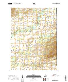
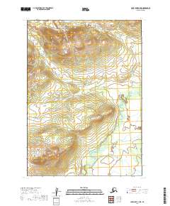
2019 Map of Lake Clark C-6 NW
USGS Topo · Published 2019About this map
The Mulchatna River meanders across this subarctic landscape in the Lake and Peninsula Borough, defining the drainage patterns of a region shaped by glacial activity and seasonal melt. The terrain is a complex network of waterways, where the river meets significant tributaries including Bonanza Cr and Summit Cr. In the southern reaches of the quadrangle, Big Bonanza Cr cuts through the shifting elevations, illustrating the hydrological connectivity of this interior Alaskan wilderness. This survey by the U.S. Geological Survey captures the area during a period of modern geospatial monitoring, emphasizing the natural boundaries of the Public Land Survey System townships like t7n r34w and t8n r33w. The map serves as a precise record of watercourses and elevation contours in a territory where the environment remains the primary architect of the land.
Find a feature on this map
10 named features on this map. Tap any name to fly to it.
Don’t see what you’re looking for? This feature index may not catch every label — zoom into the map to look around manually.
Map Details
Editions of this 2019 Lake Clark C-6 NW Map
This is the sole edition of this map. No revisions or reprints were ever made.
Other maps of this area

1946 · Lake Clark
USGS Topo · 1:250,000

1951 · Lake Clark
USGS Topo · 1:250,000

1954 · Lake Clark C-7
USGS Topo · 1:63,360

1954 · Lake Clark C-6
USGS Topo · 1:63,360

1954 · Lake Clark D-7
USGS Topo · 1:63,360
1954 · Lake Clark D-6
USGS Topo · 1:63,360

1958 · Lake Clark
USGS Topo · 1:250,000
2019 · Lake Clark C-7 SE
USGS Topo · 1:25,000
2019 · Lake Clark D-6 SW
USGS Topo · 1:25,000
2019 · Lake Clark C-7 NE
USGS Topo · 1:25,000