
1954 Map of Lake Clark C-6
USGS Topo · Published 1964About this map
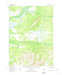
The Mulchatna River flows through the northwestern corner of this territory, forming a complex of wetlands and braided channels in the low-lying glacial plains. This mid-century survey by the Army Map Service reveals a landscape defined entirely by its hydrology, where the Chilikadrotna River cuts a distinct horizontal path across the central-southern terrain. The topographic detail, compiled from aerial photography taken in the 1950s, highlights the drainage patterns of Bonanza Creek as it winds through an area notably devoid of established roads or permanent settlements at the time of field annotation. The transition from the dense network of small lakes and ponds in the north to the increasingly steep elevation contours in the southern portion suggests a rugged natural frontier where river navigation was likely the primary means of traversal.
Find a feature on this map
4 named features on this map. Tap any name to fly to it.
Don’t see what you’re looking for? This feature index may not catch every label — zoom into the map to look around manually.
Map Details
Editions of this 1954 Lake Clark C-6 Map
2 editions found
Other maps of this area

1946 · Lake Clark
USGS Topo · 1:250,000

1951 · Lake Clark
USGS Topo · 1:250,000

1954 · Lake Clark C-7
USGS Topo · 1:63,360

1954 · Lake Clark D-7
USGS Topo · 1:63,360

1954 · Lake Clark B-5
USGS Topo · 1:63,360

1954 · Lake Clark D-5
USGS Topo · 1:63,360

1954 · Lake Clark C-5
USGS Topo · 1:63,360

1954 · Lake Clark B-6
USGS Topo · 1:63,360
1954 · Lake Clark B-7
USGS Topo · 1:63,360
1954 · Lake Clark D-6
USGS Topo · 1:63,360