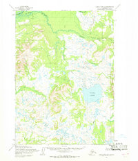
1954 Map of Lake Clark B-7
USGS Topo · Published 1968About this map
Tutna Lake dominates the central basin of this mid-century survey, surrounded by an intricate network of ponds and wetlands that define the lower drainage of the Mulchatna River. This remote landscape in the Lake and Peninsula region shows no roads or trails, preserving a view of the territory as it existed when the Army Map Service first performed the topography. The Chilchitna River cuts across the northern reaches, fed by the glacial meltwaters of Dummy Creek, while Mesa Mountain rises to the east as a prominent navigational landmark. The map documents the complex hydrography of the region, where Nikadarna Creek and Black Creek wind through a terrain marked by numerous unnamed kettle lakes and significant elevation changes, providing a clear record of the area's natural state before any significant human development occurred.
Find a feature on this map
7 named features on this map. Tap any name to fly to it.
Don’t see what you’re looking for? This feature index may not catch every label — zoom into the map to look around manually.
Map Details
Editions of this 1954 Lake Clark B-7 Map
This is the sole edition of this map. No revisions or reprints were ever made.
Other maps of this area

1946 · Lake Clark
USGS Topo · 1:250,000

1951 · Lake Clark
USGS Topo · 1:250,000

1954 · Lake Clark C-7
USGS Topo · 1:63,360

1954 · Lake Clark A-7
USGS Topo · 1:63,360

1954 · Lake Clark A-8
USGS Topo · 1:63,360

1954 · Lake Clark C-6
USGS Topo · 1:63,360

1954 · Lake Clark C-8
USGS Topo · 1:63,360

1954 · Lake Clark A-6
USGS Topo · 1:63,360

1954 · Lake Clark B-6
USGS Topo · 1:63,360
1954 · Lake Clark B-8
USGS Topo · 1:63,360