
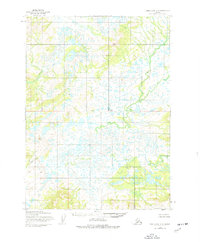
1954 Map of Lake Clark A-8
USGS Topo · Published 1964About this map
The Chulitna River winds through this expanse of southwestern Alaska, defining the low-lying drainage patterns within the Lake and Peninsula region. The landscape is characterized by a dense network of small ponds and wetlands, documented through photogrammetric methods from aerial surveys conducted in the early 1950s. A significant survey marker, the Seward Base Line, bisects the terrain, providing a critical reference point for the Bureau of Land Management's predetermined land lines. At this time, the area remained largely undeveloped, with no roads or trails recorded on the map, reflecting the remote interior wilderness before later conservation or infrastructure efforts altered the character of the Lake Clark vicinity.
Find a feature on this map
2 named features on this map. Tap any name to fly to it.
Don’t see what you’re looking for? This feature index may not catch every label — zoom into the map to look around manually.
Map Details
Editions of this 1954 Lake Clark A-8 Map
2 editions found
Other maps of this area

1946 · Lake Clark
USGS Topo · 1:250,000

1950 · Taylor Mountains
USGS Topo · 1:250,000

1951 · Lake Clark
USGS Topo · 1:250,000

1951 · Taylor Mountains
USGS Topo · 1:250,000

1951 · Dillingham
USGS Topo · 1:250,000

1952 · Iliamna
USGS Topo · 1:250,000

1954 · Lake Clark A-7
USGS Topo · 1:63,360

1954 · Iliamna D-8
USGS Topo · 1:63,360

1954 · Taylor Mountains
USGS Topo · 1:250,000

1954 · Dillingham
USGS Topo · 1:250,000