
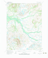
1954 Map of Iliamna D-8
USGS Topo · Published 1964About this map
The Koktuli River dominates this interior Alaskan landscape, shown here as a complex network of braided channels and wetlands that transition into the Stuyahok River and Kaskanak River systems. This 1950s survey, mapped by the Army Map Service using aerial photography, documents a terrain almost entirely devoid of human infrastructure, focusing instead on the hydrography and topographic elevation. The surveyor notes indicate that land lines represent unsurveyed and unmarked locations predetermined by the Bureau of Land Management, highlighting the remote nature of this region before any modern development or roads were established. The map provides a critical record of natural drainage patterns and unmapped wilderness in the Lake and Peninsula area during the mid-twentieth century.
Find a feature on this map
11 named features on this map. Tap any name to fly to it.
Don’t see what you’re looking for? This feature index may not catch every label — zoom into the map to look around manually.
Map Details
Editions of this 1954 Iliamna D-8 Map
2 editions found
Other maps of this area

1946 · Lake Clark
USGS Topo · 1:250,000

1950 · Taylor Mountains
USGS Topo · 1:250,000

1951 · Lake Clark
USGS Topo · 1:250,000

1951 · Taylor Mountains
USGS Topo · 1:250,000

1951 · Dillingham
USGS Topo · 1:250,000

1952 · Iliamna
USGS Topo · 1:250,000

1954 · Lake Clark A-7
USGS Topo · 1:63,360

1954 · Lake Clark A-8
USGS Topo · 1:63,360

1954 · Iliamna C-8
USGS Topo · 1:63,360

1954 · Taylor Mountains
USGS Topo · 1:250,000