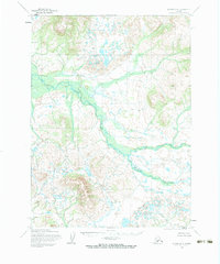
1954 Map of Iliamna D-8
USGS Topo · Published 1983About this map
Koktuli River dominates this southwestern Alaskan landscape as it was documented in the mid-1950s. The topographic detail, produced by the U.S. Geological Survey and the Army Map Service, captures a complex system of drainage and marshy lowlands surrounding the main river channel. The river's winding path serves as the central artery for this remote region, where the terrain is defined by dramatic elevation changes and a network of unnamed tributaries. To the southeast, the labeling of Kaskunuk provides a rare point of reference in an otherwise unsettled expanse. The map reflects a period of intensive aerial survey and photogrammetry, illustrating the glacial and fluvial processes that shaped this wilderness before modern infrastructure reached the interior.
Find a feature on this map
2 named features on this map. Tap any name to fly to it.
Don’t see what you’re looking for? This feature index may not catch every label — zoom into the map to look around manually.
Map Details
Editions of this 1954 Iliamna D-8 Map
2 editions found
Other maps of this area

1946 · Lake Clark
USGS Topo · 1:250,000

1950 · Taylor Mountains
USGS Topo · 1:250,000

1951 · Lake Clark
USGS Topo · 1:250,000

1951 · Taylor Mountains
USGS Topo · 1:250,000

1951 · Dillingham
USGS Topo · 1:250,000

1952 · Iliamna
USGS Topo · 1:250,000

1954 · Lake Clark A-7
USGS Topo · 1:63,360

1954 · Lake Clark A-8
USGS Topo · 1:63,360

1954 · Iliamna C-8
USGS Topo · 1:63,360

1954 · Iliamna D-8
USGS Topo · 1:63,360