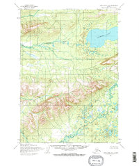
1954 Map of Lake Clark D-6
USGS Topo · Published 1968About this map
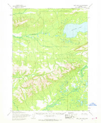
Whitefish Lake dominates the upper-right quadrant of this mid-century Alaskan interior landscape, feeding a complex drainage system that includes the Hohotitna River and numerous unnamed ponds. Mapped from aerial photography taken between 1953 and 1957 by the Army Map Service, this region is characterized by significant topographic relief, with prominent peaks like Summit, Dhani, and Hono rising above the river valleys. The southern portion of the sheet is defined by the winding course of the Mulchatna River, which meanders through a low-lying basin dotted with water bodies such as Half Cabin Lake. This survey represents the era before modern development, showing a wilderness where the Bureau of Land Management had predetermined unsurveyed land lines, yet no roads or trails were recorded. Local landmarks like Gnat Creek and the associated Gnat elevation provide reference points in a terrain primarily shaped by glacial and alluvial forces.
Find a feature on this map
9 named features on this map. Tap any name to fly to it.
Don’t see what you’re looking for? This feature index may not catch every label — zoom into the map to look around manually.
Map Details
Editions of this 1954 Lake Clark D-6 Map
2 editions found
Other maps of this area

1946 · Lake Clark
USGS Topo · 1:250,000

1951 · Lake Clark
USGS Topo · 1:250,000

1951 · Lime Hills
USGS Topo · 1:250,000

1954 · Lake Clark C-7
USGS Topo · 1:63,360

1954 · Lake Clark C-6
USGS Topo · 1:63,360

1954 · Lake Clark D-7
USGS Topo · 1:63,360

1954 · Lime Hills A-5
USGS Topo · 1:63,360

1954 · Lake Clark D-5
USGS Topo · 1:63,360

1954 · Lake Clark C-5
USGS Topo · 1:63,360

1954 · Lime Hills A-7
USGS Topo · 1:63,360