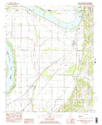
1982 Map of Lake Cormorant
USGS Topo · Published 1982About this map
The Mississippi River floodplain defines this tri-state border region, where the winding waters of Horn Lake and Mud Lake mark the boundaries between Mississippi and Tennessee. During the early 1980s, the landscape was a mix of fertile delta agriculture and growing infrastructure, anchored by the Illinois Central Gulf railroad line. Small community centers such as Walls, Glover, and Lake Cormorant appear alongside the intricate drainage patterns of Dead Slough and Negro Slough. The presence of the Twinkle Town Landing Field and a significant Pipe Line Compressor Station suggests an era of increasing industrial and utility development in the rural South. Geographers will note the complex hydrology where Jackson Creek and Johnson Creek meet the low-lying bayous and ponds of the Mississippi bottomlands.
Find a feature on this map
31 named features on this map. Tap any name to fly to it.
Don’t see what you’re looking for? This feature index may not catch every label — zoom into the map to look around manually.
Map Details
Editions of this 1982 Lake Cormorant Map
2 editions found
Other maps of this area

1908 · Lake Cormorant
USGS Topo · 1:24,000

1912 · Lake Cormorant
USGS Topo · 1:31,680

1916 · Memphis
USGS Topo · 1:62,500

1925 · Memphis
USGS Topo · 1:48,000

1927 · Memphis
USGS Topo · 1:62,500

1931 · Horseshoe Lake
USGS Topo · 1:62,500

1932 · Horn Lake
USGS Topo · 1:48,000

1935 · Horn Lake
USGS Topo · 1:62,500

1939 · Horseshoe Lake
USGS Topo · 1:62,500

1939 · Edmondson
USGS Topo · 1:62,500