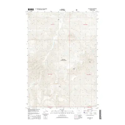
2015 Map of Lake Creek
USGS Topo · Published 2015About this map
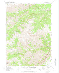
The Absaroka Range and the high elevations of the Shoshone National Forest dominate this mid-2010s topographic survey of Park County. The landscape is defined by its complex drainage network, where the Elk Fork and Lake Cr collect waters from numerous high-altitude tributaries like Burned Timber Cr and Swede Cr. The eastern portion of the map is anchored by the imposing Wapiti Ridge, while deep incisions such as Bear Gulch and Cut Coulee indicate the erosive power of seasonal snowmelt and runoff. Unlike many regions where human infrastructure dictates the map's character, this area remains remarkably undeveloped, focused entirely on the natural contours of the mountain wilderness. Researchers can trace the flow of Rampart Cr and Bloom Cr as they navigate the ridges and basins that define this corner of the Wyoming backcountry.
Find a feature on this map
22 named features on this map. Tap any name to fly to it.
Don’t see what you’re looking for? This feature index may not catch every label — zoom into the map to look around manually.
Map Details
Editions of this 2015 Lake Creek Map
This is the sole edition of this map. No revisions or reprints were ever made.
Other maps of this area

1893 · Ishawooa
USGS Topo · 1:125,000

1895 · Ishawooa
USGS Topo · 1:125,000

1899 · Ishawooa
USGS Topo · 1:125,000

1955 · Cody
USGS Topo · 1:250,000

1958 · Cody
USGS Topo · 1:250,000

1962 · Cody
USGS Topo · 1:250,000
1970 · Sheep Mesa
USGS Topo · 1:24,000
1970 · Ptarmigan Mountain
USGS Topo · 1:24,000
1970 · Chimney Rock
USGS Topo · 1:24,000
1970 · Clouds Home Peak
USGS Topo · 1:24,000