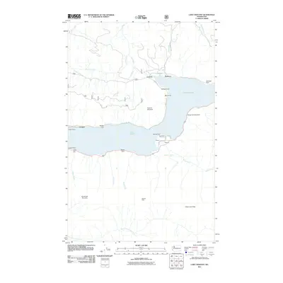
2011 Map of Lake Crescent
USGS Topo · Published 2011About this map
Lake Crescent dominates this Olympic Peninsula landscape, its deep waters framed by the steep slopes of Pyramid Mountain and Sourdough Mountain. Along the northern and eastern shores, the small settlements of Crescent and Piedmont represent long-standing lakeside communities, while smaller locales like Rosemary, Singers, and Ovington dot the shoreline where early 20th-century tourism and timber interests converged. The map reveals a transition from rail to recreation, notably through the Spruce RR Trl, which follows the path of a historic Spruce Production Division railway built during World War I. This infrastructure, once vital for the timber industry, now serves as a corridor for exploring the lake's perimeter. Dramatic topography is marked by Aurora Peak and Happy Lake Ridge, with several water features feeding the lake, including Marymere Falls, Barnes Creek, and the Lyre River, which serves as the lake's outlet.
Find a feature on this map
40 named features on this map. Tap any name to fly to it.
Don’t see what you’re looking for? This feature index may not catch every label — zoom into the map to look around manually.
Map Details
Editions of this 2011 Lake Crescent Map
This is the sole edition of this map. No revisions or reprints were ever made.
Other maps of this area

1918 · Lake Crescent
USGS Topo · 1:62,500

1919 · Port Crescent
USGS Topo · 1:62,500

1922 · Lake Crescent
USGS Topo · 1:62,500

1935 · Mount Olympus
USGS Topo · 1:62,500

1939 · Mount Tom
USGS Topo · 1:62,500

1942 · Mount Olympus
USGS Topo · 1:62,500

1950 · Mount Muller
USGS Topo · 1:24,000

1950 · Lake Sutherland
USGS Topo · 1:24,000

1950 · Twin Rivers
USGS Topo · 1:24,000
1950 · Joyce
USGS Topo · 1:24,000