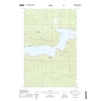
2020 Map of Lake Crescent
USGS Topo · Published 2020About this map
Lake Crescent dominates the central landscape of this Olympic Peninsula survey, serving as a focal point for the surrounding mountainous terrain. To the north, the small settlements of Crescent and Piedmont sit along the shoreline, while the former resort site of Ovington is located on the western bank. The map reveals a complex network of historical transportation routes, most notably the Spruce Railroad Trail, which traces the northern shore through land managed by both Olympic National Forest and Olympic National Park.
Find a feature on this map
57 named features on this map. Tap any name to fly to it.
Don’t see what you’re looking for? This feature index may not catch every label — zoom into the map to look around manually.
Map Details
Editions of this 2020 Lake Crescent Map
This is the sole edition of this map. No revisions or reprints were ever made.
Other maps of this area

1918 · Lake Crescent
USGS Topo · 1:62,500

1919 · Port Crescent
USGS Topo · 1:62,500

1922 · Lake Crescent
USGS Topo · 1:62,500

1935 · Mount Olympus
USGS Topo · 1:62,500

1939 · Mount Tom
USGS Topo · 1:62,500

1942 · Mount Olympus
USGS Topo · 1:62,500

1950 · Mount Muller
USGS Topo · 1:24,000

1950 · Lake Sutherland
USGS Topo · 1:24,000

1950 · Twin Rivers
USGS Topo · 1:24,000
1950 · Joyce
USGS Topo · 1:24,000