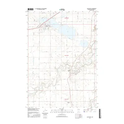
2016 Map of Lake Crystal
USGS Topo · Published 2016About this map
The Watonwan River winds through the southern landscape of this 2016 survey, joining the Blue Earth River near the eastern boundary of Blue Earth County. The northern portion of the map is dominated by a chain of water bodies, including Lily Lake, the larger Lake Crystal, and Loon Lake. The settlement of Lake Crystal is positioned between these waters, showing a developed street grid with names like W Blue Earth St and Lakeview Rd. Southward, the village of Garden City sits along the river's bend, where local landmarks like the Garden City Cem provide points of interest for genealogists. The terrain is characterized by the drainage patterns of Minneopa Cr and the river valleys, contrasting with the organized agricultural plots and county roads like Co Rd 20 that define the surrounding rural area. Nearby, the Bergemann Airport serves the region from its location just south of the main river valley.
Find a feature on this map
39 named features on this map. Tap any name to fly to it.
Don’t see what you’re looking for? This feature index may not catch every label — zoom into the map to look around manually.
Map Details
Editions of this 2016 Lake Crystal Map
This is the sole edition of this map. No revisions or reprints were ever made.
Other maps of this area

1951 · Mankato West
USGS Topo · 1:62,500

1953 · New Ulm
USGS Topo · 1:250,000

1954 · Fairmont
USGS Topo · 1:250,000

1957 · New Ulm
USGS Topo · 1:250,000

1958 · New Ulm
USGS Topo · 1:250,000

1958 · Fairmont
USGS Topo · 1:250,000

1965 · Perth
USGS Topo · 1:24,000

1965 · Cambria
USGS Topo · 1:24,000

1967 · New Ulm
USGS Topo · 1:250,000

1967 · Willow Creek
USGS Topo · 1:24,000