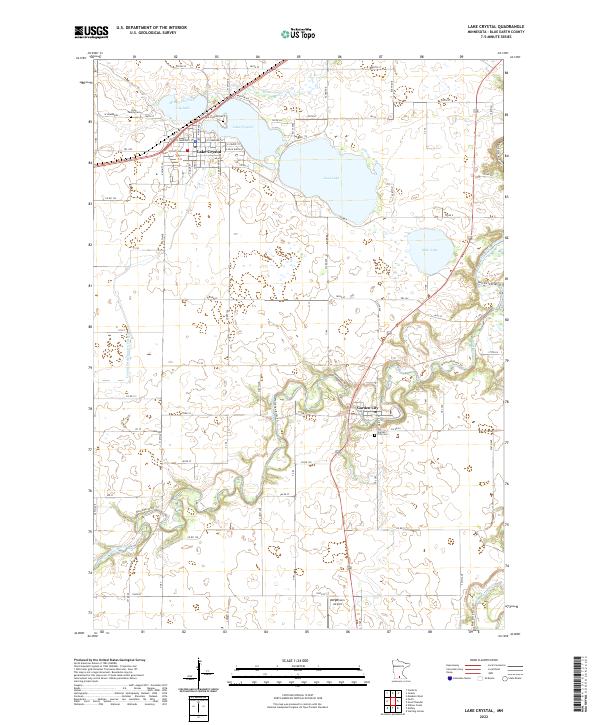
2022 Map of Lake Crystal
USGS Topo · Published 2022About this map
Lake Crystal serves as the primary hub of this Blue Earth County landscape, positioned along the northern shores of its namesake lake and Lily Lake. The settlement pattern reflects a deeply rooted community, evidenced by well-defined burial grounds such as Holy Family Cem and the Lake Crystal Cem. Moving south, the terrain is defined by the winding course of the Watonwan River, which flows toward the smaller village of Garden City. This area highlights the transition from lacustrine environments like Loon Lake and Mills Lake to a riverine system supported by extensive drainage projects like County Ditch Number Fifty-six. Near the southern edge, the Bergemann Airport stands as a notable local landmark, while historical trail systems like the Watonwan River Trl follow the natural contours of the valley, marking the region's enduring connection to its water resources.
Find a feature on this map
52 named features on this map. Tap any name to fly to it.
Don’t see what you’re looking for? This feature index may not catch every label — zoom into the map to look around manually.
Map Details
Editions of this 2022 Lake Crystal Map
This is the sole edition of this map. No revisions or reprints were ever made.
Other maps of this area

1951 · Mankato West
USGS Topo · 1:62,500

1953 · New Ulm
USGS Topo · 1:250,000

1954 · Fairmont
USGS Topo · 1:250,000

1957 · New Ulm
USGS Topo · 1:250,000

1958 · New Ulm
USGS Topo · 1:250,000

1958 · Fairmont
USGS Topo · 1:250,000

1965 · Perth
USGS Topo · 1:24,000

1965 · Cambria
USGS Topo · 1:24,000

1967 · New Ulm
USGS Topo · 1:250,000

1967 · Willow Creek
USGS Topo · 1:24,000