1973 Map of Lake Cuatro Caballo
USGS Topo · Published 1976About this map
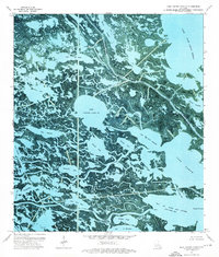
Lake Cuatro Caballo and its surrounding wetlands define this orthophotomap of the coastal marshes in the early 1970s. The landscape is a complex web of bayous, lakes, and lagoons marking the border between St Bernard Parish and Plaquemines Parish. Key waterways like Bayou Terre Aux Boeufs and River Aux Chenes carve through the sediment, while named features such as Pintail Flat and Grassy Point rise above the tide. Several industrial markers, labeled as Drill Holes and Gas Wells, are scattered across the marsh, reflecting the mid-century energy exploration that moved into these remote reaches. The map captures the area just as the Geological Survey noted it was within a subsidence area, providing a precise record of these shifting shorelines near Lake Campo and Lake Jean Louis Robin.
Find a feature on this map
40 named features on this map. Tap any name to fly to it.
Don’t see what you’re looking for? This feature index may not catch every label — zoom into the map to look around manually.
Map Details
Editions of this 1973 Lake Cuatro Caballo Map
2 editions found

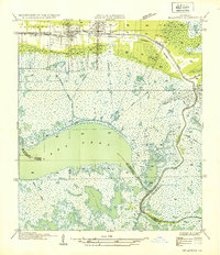
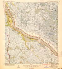
Other maps of this area

1891 · Pointe a La Hache
USGS Topo · 1:62,500

1892 · St. Bernard
USGS Topo · 1:62,500

1892 · Pointe a La Hache
USGS Topo · 1:62,500

1893 · Shell Beach
USGS Topo · 1:62,500

1893 · Dime
USGS Topo · 1:62,500
1935 · Delacroix
USGS Topo · 1:31,680

1935 · Lake Calebasse
USGS Topo · 1:31,680

1935 · Lake Batola
USGS Topo · 1:31,680

1939 · Shell Beach
USGS Topo · 1:62,500
1939 · Pointe a La Hache
USGS Topo · 1:62,500