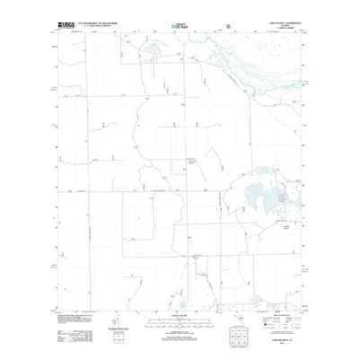
2012 Map of Lake Delancy
USGS Topo · Published 2012About this map
Lake Delancy and the surrounding pine-dominated terrain of the Ocala National Forest define this part of Marion County during the early 21st century. The landscape is a mosaic of sandy ridges and low-lying wetlands, marked by unique geological features like Riverside Island and Norwalk Island. Water is a central element of the map, from the winding course of the Ocklawaha River in the northeast to smaller basins like Penner Ponds and Prairie Pond.
Find a feature on this map
26 named features on this map. Tap any name to fly to it.
Don’t see what you’re looking for? This feature index may not catch every label — zoom into the map to look around manually.
Map Details
Editions of this 2012 Lake Delancy Map
This is the sole edition of this map. No revisions or reprints were ever made.
Other maps of this area

1912 · Palatka
USGS Topo · 1:48,000

1915 · Palatka
USGS Topo · 1:62,500

1915 · Interlachen
USGS Topo · 1:48,000

1916 · Interlachen
USGS Topo · 1:62,500

1944 · Interlachen
USGS Topo · 1:62,500

1949 · Keuka
USGS Topo · 1:24,000

1949 · Rodman
USGS Topo · 1:24,000

1949 · Interlachen
USGS Topo · 1:62,500

1954 · Daytona Beach
USGS Topo · 1:250,000

1958 · Daytona Beach
USGS Topo · 1:250,000