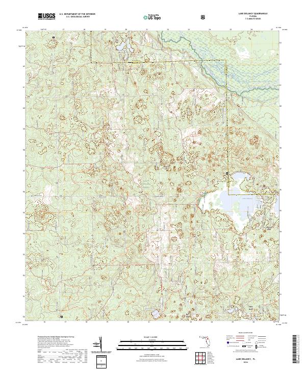
2024 Map of Lake Delancy
USGS Topo · Published 2024About this map
Ocala National Forest dominates this Central Florida landscape, where the sandy terrain is carved by a dense network of recreational paths and historic tracks. In the southern reaches, the settlement of Kerr City sits near the shores of Lake Kerr, providing a focal point for local history at the forest's edge. The geography is defined by numerous depressions and water bodies, ranging from the expansive Lake Delancy to the clusters of Penner Ponds and the marshy margins of the Ocklawaha River in the northeast.
Find a feature on this map
45 named features on this map. Tap any name to fly to it.
Don’t see what you’re looking for? This feature index may not catch every label — zoom into the map to look around manually.
Map Details
Editions of this 2024 Lake Delancy Map
This is the sole edition of this map. No revisions or reprints were ever made.
Other maps of this area

1912 · Palatka
USGS Topo · 1:48,000

1915 · Palatka
USGS Topo · 1:62,500

1915 · Interlachen
USGS Topo · 1:48,000

1916 · Interlachen
USGS Topo · 1:62,500

1944 · Interlachen
USGS Topo · 1:62,500

1949 · Keuka
USGS Topo · 1:24,000

1949 · Rodman
USGS Topo · 1:24,000

1949 · Interlachen
USGS Topo · 1:62,500

1954 · Daytona Beach
USGS Topo · 1:250,000

1958 · Daytona Beach
USGS Topo · 1:250,000