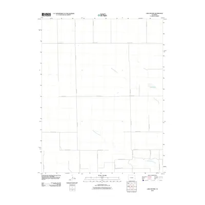
2010 Map of Lake Devore
USGS Topo · Published 2010About this map
Lake Devore sits in an open, arid landscape of southeastern Colorado, defined by a strictly organized grid of rural roads and the meandering paths of intermittent waterways. This 2010 survey shows the section-line planning typical of the High Plains, where routes like County Road G and County Road D segment the terrain into vast agricultural or grazing blocks. The drainage system is dominated by the ephemeral Wild Horse Creek and its tributary, West Wild Horse Creek, which cut subtle paths across the eastern and southern portions of the quadrangle.
Find a feature on this map
21 named features on this map. Tap any name to fly to it.
Don’t see what you’re looking for? This feature index may not catch every label — zoom into the map to look around manually.
Map Details
Editions of this 2010 Lake Devore Map
This is the sole edition of this map. No revisions or reprints were ever made.
Other maps of this area

1890 · Granada
USGS Topo · 1:125,000

1892 · Granada
USGS Topo · 1:125,000

1894 · Granada
USGS Topo · 1:125,000

1954 · Lamar
USGS Topo · 1:250,000

1955 · Holly NE
USGS Topo · 1:24,000

1955 · Granada NE
USGS Topo · 1:24,000
1955 · Holly NW
USGS Topo · 1:24,000

1958 · Lamar
USGS Topo · 1:250,000

1968 · Stuart
USGS Topo · 1:24,000

1968 · Sheridan Lake
USGS Topo · 1:24,000