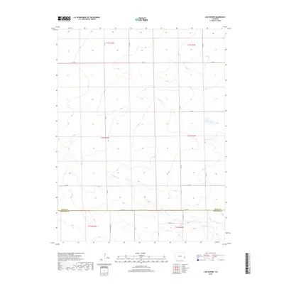
2019 Map of Lake Devore
USGS Topo · Published 2019About this map
Kiowa Co Prowers Co marks the southern boundary of this remote plains landscape, where the seasonal drainage of Wild Horse Cr and its western branch, W Wild Horse Cr, weave through the open section-line grid. The high plains geography is defined by a sparse network of county roads including Co RD G and Co RD 75, which serve isolated ranching properties and agricultural plots. A primary focal point in this arid terrain is Lake Devore, a small water body that stands out against the surrounding dry creek beds. This 2019 survey documents the modern layout of rural infrastructure, showing the intersection of long-standing township boundaries like t20s r42w with the functional road network of the Colorado plains.
Find a feature on this map
21 named features on this map. Tap any name to fly to it.
Don’t see what you’re looking for? This feature index may not catch every label — zoom into the map to look around manually.
Map Details
Editions of this 2019 Lake Devore Map
This is the sole edition of this map. No revisions or reprints were ever made.
Other maps of this area

1890 · Granada
USGS Topo · 1:125,000

1892 · Granada
USGS Topo · 1:125,000

1894 · Granada
USGS Topo · 1:125,000

1954 · Lamar
USGS Topo · 1:250,000

1955 · Holly NE
USGS Topo · 1:24,000

1955 · Granada NE
USGS Topo · 1:24,000
1955 · Holly NW
USGS Topo · 1:24,000

1958 · Lamar
USGS Topo · 1:250,000

1968 · Stuart
USGS Topo · 1:24,000

1968 · Sheridan Lake
USGS Topo · 1:24,000